Playa Malibu
Panamá Oeste 27°C · Partly cloudy

Playa Malibu

Beaches and islands
Back to Explore
Province Panamá Oeste

Practical information

The essentials for planning your visit.

Duration Half day
Difficulty Easy
Best time All year
Price Free
Suggested vehicle Sedan & SUV
Destination guide

About this place

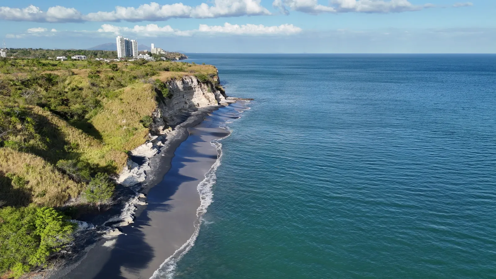
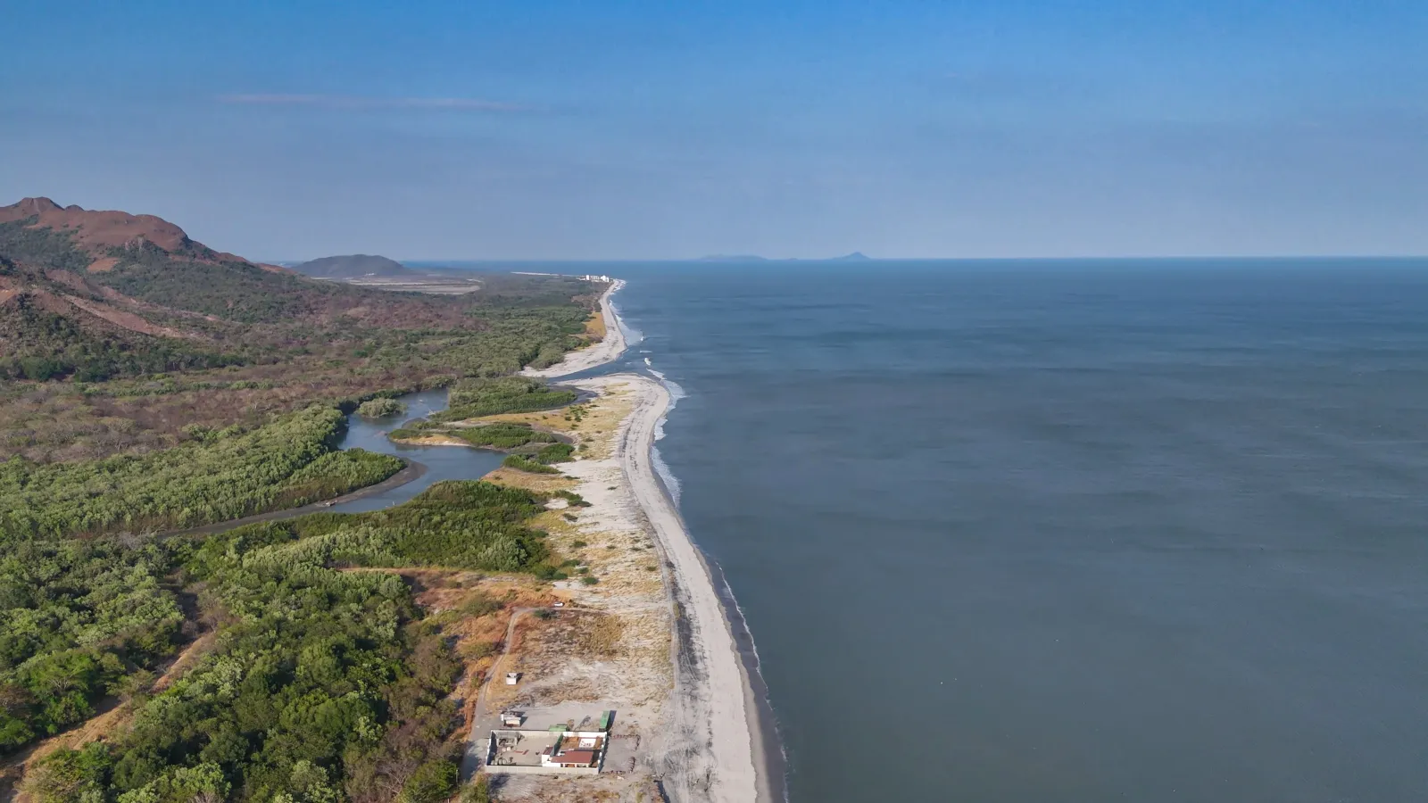
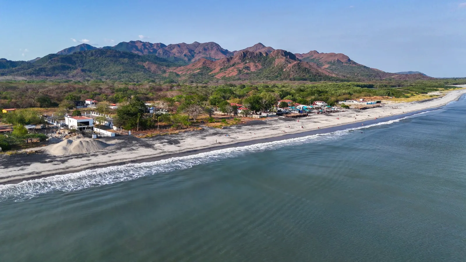
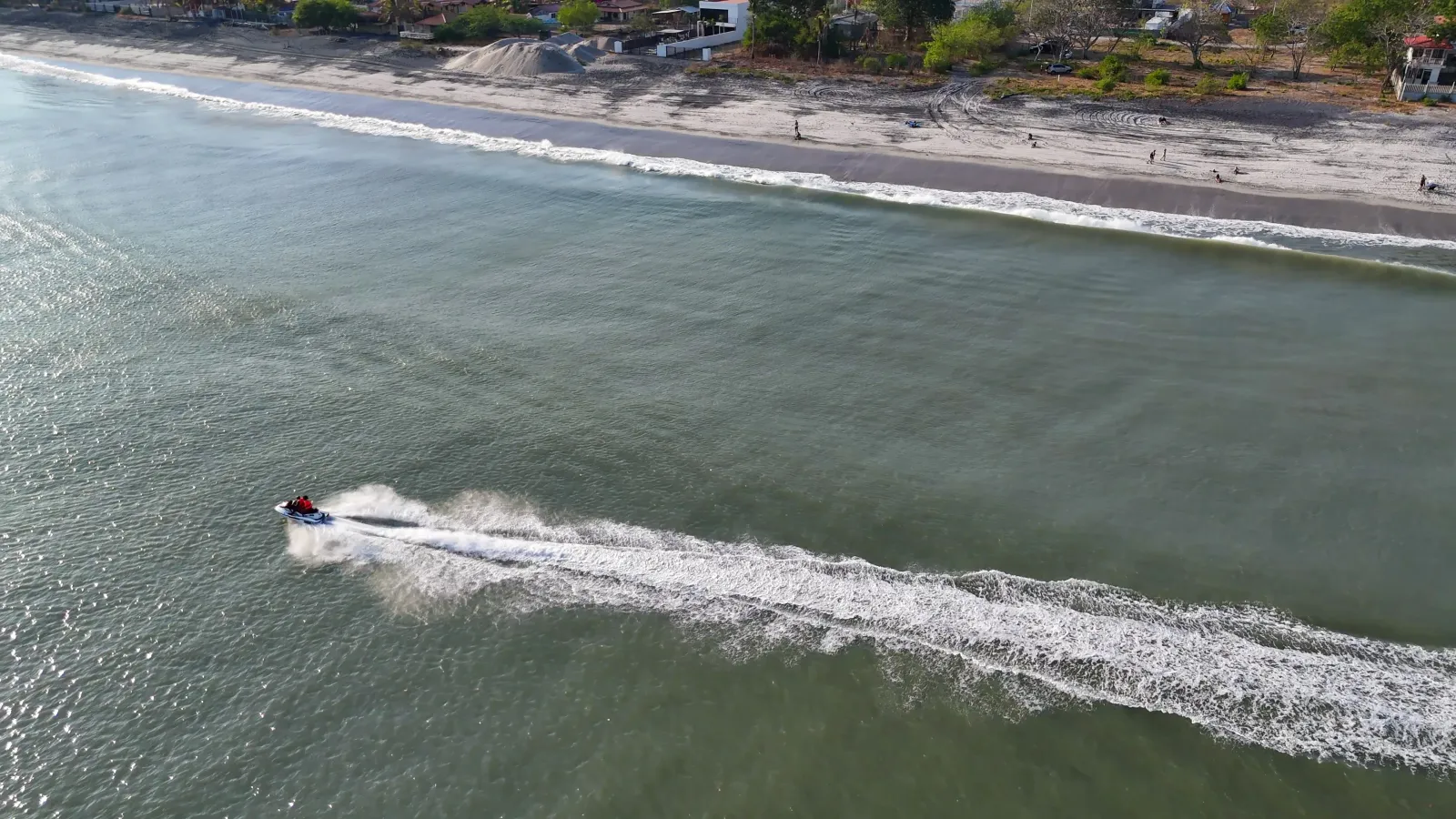
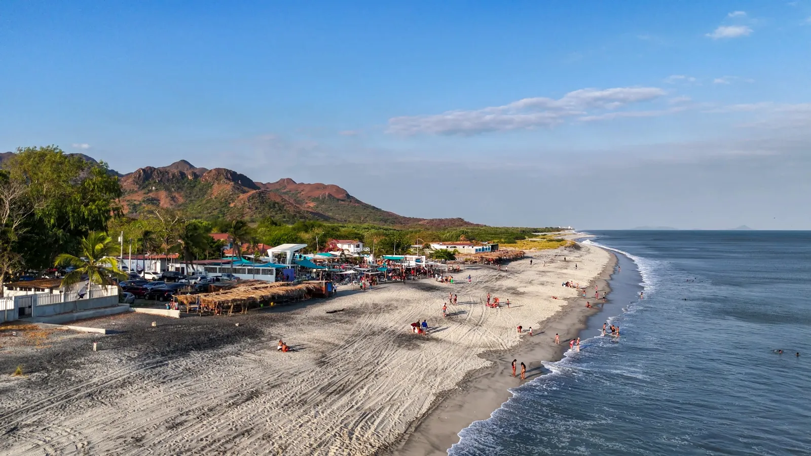
Arriving at Playa Malibu, the road opens onto an exposed coastline where the sand takes on grayish tones from a mixture of lighter and darker sediments. The mouth of the Chame River shapes the scenery and helps create one of the best-known surf breaks along Panama Oeste’s Pacific Riviera. The beach retains a mostly natural atmosphere, with a long stretch of coastline and few facilities directly on the sand. Its character is closely connected to the movement of the sea: the waves attract surfers, and the experience changes with the tide, wind and daily swell. Visitors can also walk along the shore, observe where the river meets the Pacific and enjoy a coastal setting that feels less developed than some nearby beaches. Playa Malibu is located in Nueva Gorgona, within the district of Chame. The shoreline and water can be enjoyed when conditions are suitable, but the surf may become strong. Before visiting, check tide tables, review marine forecasts and follow any SINAPROC advisories concerning high surf, erosion or coastal scouring.

Explore the place

Image gallery

Understand the place

History

Playa Malibu forms part of the coastline of Nueva Gorgona, in the district of Chame. Its name is officially recognized as a locality within the corregimiento, and as Panama’s Pacific Riviera developed as a tourism region, the beach became particularly associated with surfing. Unlike coastal destinations organized around large resorts or waterfront promenades, its recognition comes mainly from the natural conditions of the shoreline and the relationship between the mouth of the Chame River and the Pacific swell. Detailed historical information about the origin of the name Malibu and the development of this specific coastal sector remains pending specialized documentation.
Culture

The experience at Playa Malibu is mainly connected to beach culture and the surfing practiced along the coast of Chame. Surfers and local visitors come to observe sea conditions, walk along the shoreline or spend part of the day beside the Pacific. Nearby accommodations, small businesses and beach-related service providers may be available, although their schedules and operations vary. These private businesses should not be confused with a general administration for Playa Malibu. The visit takes place within the everyday setting of Nueva Gorgona and nearby coastal communities, so visitors should move through the area respectfully, avoid blocking access routes and remove all waste.

Climate

The experience changes with rainfall, wind, tides and conditions in the Pacific. Strong surf may occur even on sunny days, while heavy rainfall can affect the local road, increase runoff and alter conditions near the mouth of the Chame River. The swell is an essential part of Playa Malibu’s character, but it also requires caution. Recent episodes of erosion, coastal scouring and damage associated with intense sea conditions have been documented. Before entering the water, check the tide and surf forecast. During high-surf or long-period swell advisories, remain out of the water and avoid affected coastal areas.

Area and surroundings

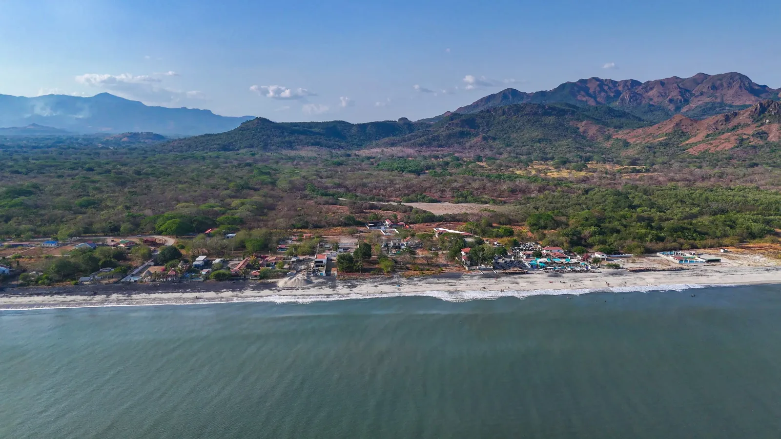
Playa Malibu is an open stretch of coastline located in Nueva Gorgona. Its setting combines a long beach, grayish sand, the Pacific Ocean and the nearby influence of the mouth of the Chame River. Road access begins through Coloncito and continues along a local road toward the coast. The beach does not operate as a gated attraction and has no single administrative entrance. Nearby facilities and businesses are privately operated and should not be considered guaranteed services for the entire beach. Because of the dynamic coastline, the shape of the shore, walkable areas and some coastal sections may change after periods of strong surf or erosion.

Nature

Playa Malibu’s most distinctive natural feature is the meeting point between the Pacific shoreline and the mouth of the Chame River. Water movement carries and redistributes sediment, contributing to the mixture of light and dark tones in the sand and to the beach’s changing surf conditions. The beach offers a direct view of coastal processes: tides alter the width of the shoreline, currents shift around the river mouth and waves temporarily reshape the coastal profile. These same processes help explain why some sections may experience erosion or scouring. Sightings of specific wildlife should not be guaranteed because no biological inventory published exclusively for this section of beach was identified. The best way to appreciate its natural setting is to observe without disturbing the river mouth, remove all waste and keep a respectful distance from any animals encountered along the shore.

Practical tips

Check tide tables and the surf forecast before leaving, especially when planning to swim or surf. Sea conditions can change quickly and may include strong waves, currents and breaking zones near the river mouth. Bring drinking water, sun protection and footwear suitable for hot sand or wet coastal sections. Do not rely on finding restrooms, showers, lifeguards, shade or open businesses directly on the beach. When using a surf school, parking area or private establishment, confirm its services and fees in advance. Check the condition of the road from Coloncito, particularly after rainfall or periods of strong surf. Follow SINAPROC signage and never cross safety barriers or approach scoured areas and structures affected by erosion. Keep valuables supervised and remove all waste.

How to get there

Access to Playa Malibu is through Coloncito. From the turnoff, follow the local road toward the coast until you reach the beach area. Because road conditions may change after heavy rainfall or periods of strong surf, check the route before setting out and review any current SINAPROC advisories. Follow all posted signs and avoid sections affected by erosion, coastal scouring or other damage.

Opening hours

No general schedule applies. Playa Malibu is an open coastal area without a single administration or confirmed operating hours. Visit during daylight and check tides, surf conditions, road access and any SINAPROC advisories beforehand.

Geographic location

Open in Google Maps

Tags

Beach Travel photography Practical guide Surfing Coastal nature River mouth Ocean swell Pacific Riviera
Nearby

More destinations in Panamá Oeste

Punta Chame
Panamá Oeste 🚙 Sedan & SUV

Punta Chame

The road into Punta Chame follows a long, narrow peninsula where the sea appears on both sides along different...

Beaches and islands
View details
Playa Los Panamá
Panamá Oeste 🚙 Sedan & SUV

Playa Los Panamá

Playa Los Panamá is a broad Pacific beach in Panama Oeste, located about five minutes from the Inter-American...

Beaches and islands
View details
Laguna de San Carlos and Cerro Picacho
Panamá Oeste 🚙 Sedan & SUV

Laguna de San Carlos and Cerro Picacho

The still water of Laguna de San Carlos appears among the mountains as the beginning of an experience that cha...

Mountains and viewpoints
View details
PanamAdventure

Rate this destination

Share your experience at Playa Malibu

How would you rate your experience? *