Price
Pending verification. No recent official rate was found confirming the general cost of admission, camping, parking, or other services.
Suggested vehicle
Sedan & SUV
Destination guide
About this place
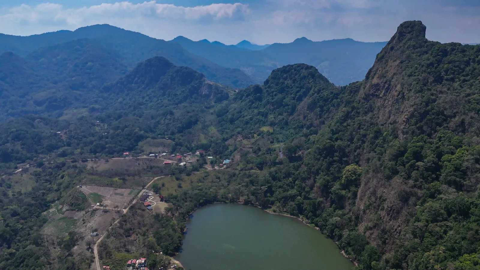
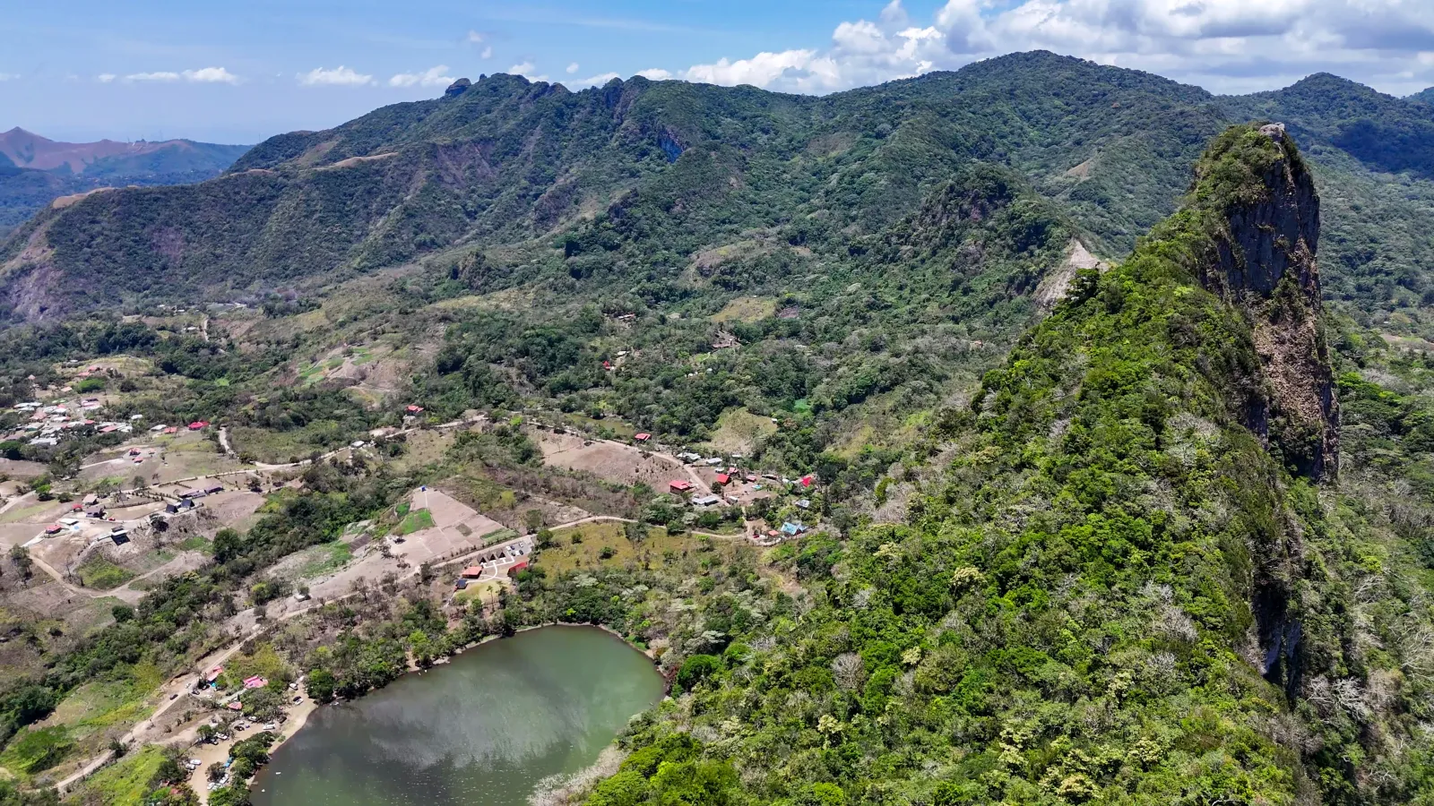
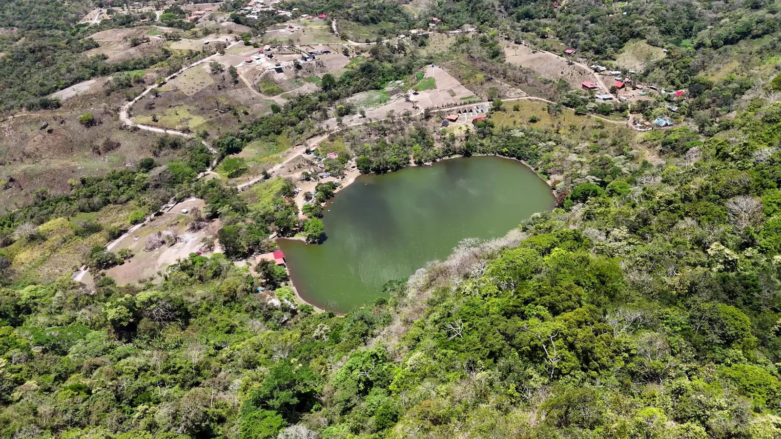
The still water of Laguna de San Carlos appears among the mountains as the beginning of an experience that changes as visitors approach the slopes of Cerro Picacho. From the lagoon area, the landscape offers space to rest by the shore, camp, or begin a hiking route leading toward higher viewpoints overlooking the water and the surrounding terrain of Panamá Oeste.
The lagoon and the mountain are separate natural features, but together they form a closely connected visitor experience. The lagoon serves as a recreational area and a reference point for reaching the trail, while Cerro Picacho provides the ascent, mountain terrain, and broader views of the area. Camping, hiking, landscape observation, and recreational fishing are among the documented uses of the destination.
The visit takes place within the corregimiento of La Laguna, a community territory that also includes agricultural activities and local enterprises. Before traveling, visitors should confirm trail conditions, access arrangements, opening hours, fees, and current rules, since no recent official source was found that consolidates all operating information.
Explore the place
Image gallery
Photo of 3
Understand the place
History
The specific documented history of Laguna de San Carlos and Cerro Picacho still requires further research. No academic or institutional source was found that fully explains the development of recreational use in the area, changes in its administration, or the creation of the hiking trail.
What has been confirmed is its contemporary recognition within the planning framework of the district of San Carlos. The district's strategic plan identifies the lagoon as a natural attraction used for recreation, recreational fishing, camping, and hiking, while recognizing Cerro Picacho as a significant elevation within the corregimiento of La Laguna.
In recent years, environmental institutions, local authorities, and community participants have assessed the territory's ecotourism potential. This process shows that the destination's present importance is connected not only to its landscape, but also to the way the community organizes and develops nature-based activities.
Culture
The visitor experience is part of life within the corregimiento of La Laguna and should not be separated from its community setting. The territory includes settlements, homes, agricultural activities, and local enterprises, in addition to the natural areas visited by hikers and campers.
MiAMBIENTE has documented the participation of local authorities, community organizers, and potential community-based organizations in efforts to strengthen ecotourism. It has also recognized several points within the territory, including the lagoon entrance and the access to the Cerro Picacho trail.
For visitors, this relationship means traveling through a place that forms part of a community's everyday environment. Behaving respectfully, carrying out waste, and using local services responsibly helps tourism maintain a more balanced relationship with the people who live in the area.
Climate
Rain and humidity directly affect the experience. The Cerro Picacho trail includes slopes, roots, and uneven sections that may become slippery when wet. Mist has also been documented and can reduce visibility from the higher portions of the route.
No official calendar of recommended months or seasonal closures was confirmed. Before beginning the ascent, visitors should review recent weather conditions and confirm the state of the trail, especially after heavy rainfall. Rain, humidity, and rapid changes in visibility may still occur during periods with lower precipitation.
Area and surroundings
The destination combines a natural body of water with a mountain elevation. Laguna de San Carlos contains the main recreational area, spaces associated with camping, and the reference point used to reach the trail. From this sector, the landscape transitions toward the slopes of Cerro Picacho.
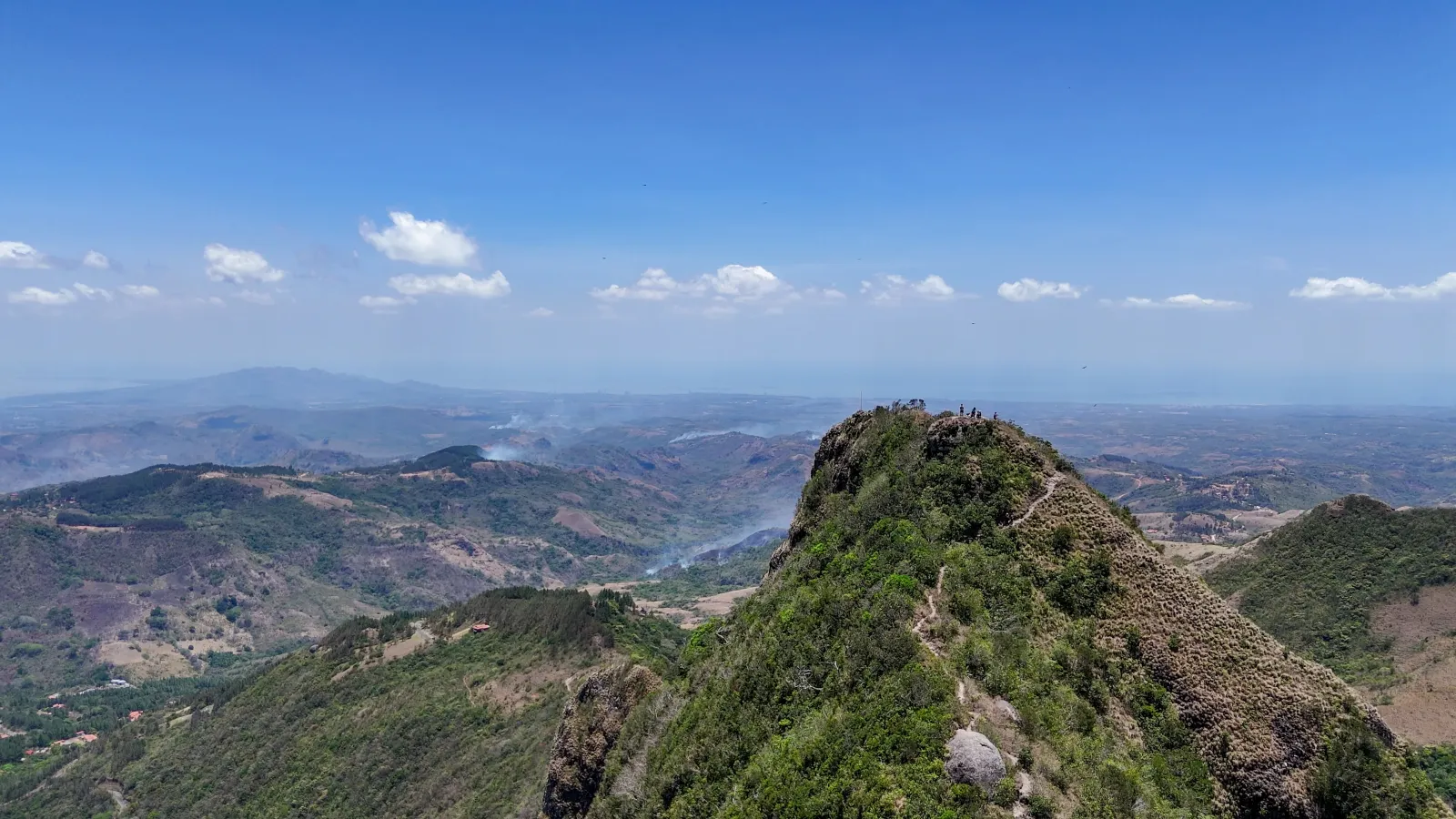
The documented route includes a fork leading either toward Cerro Picacho or to the area known as Mirador de la Laguna. The ascent crosses inclined terrain with roots and narrow sections, while the higher portions provide views of the lagoon and surrounding relief.
The exact extent of public-use areas, the boundaries of administered land, the location of visitor services, and the current condition of the infrastructure remain pending verification.
Nature
The combination of lagoon and mountain defines the destination's natural character. The body of water lies among elevated terrain, while Cerro Picacho forms part of the mountain landscape associated with the Cordillera Central. Their proximity allows visitors to move from a shoreline environment to an ascending trail during the same visit.
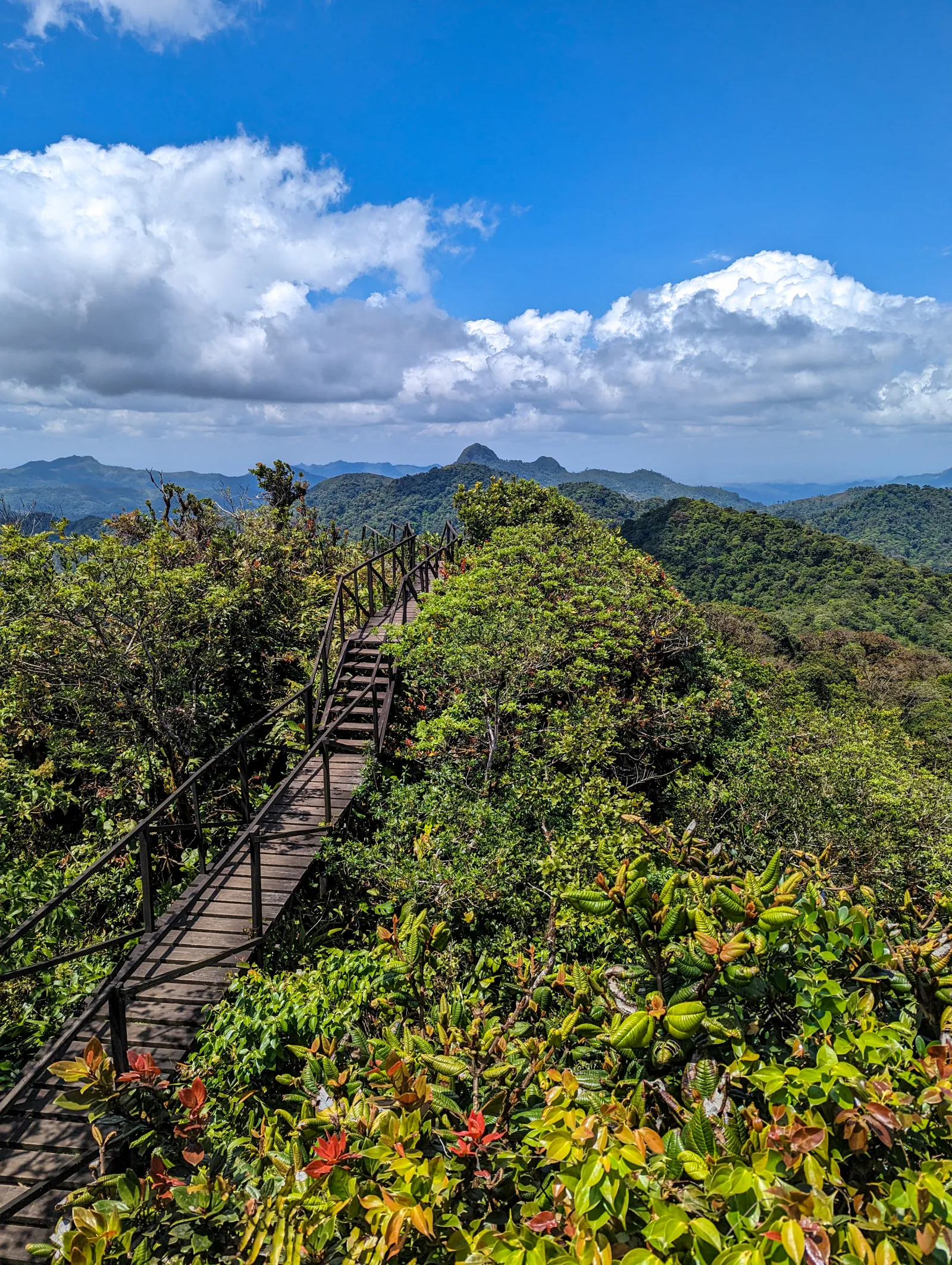
The experience is shaped by observing how the landscape changes with elevation, from the immediate surroundings of the lagoon to open views across the water and nearby mountains. Humidity, mist, and the vegetation along the route also influence how the destination is perceived.
No recent site-specific biological inventory was found that would support a reliable list of species. Wildlife should be understood as a natural possibility rather than a guaranteed sighting. Water quality and the current conditions governing swimming or other aquatic activities also remain pending verification.
Practical tips
Wear footwear with reliable traction when hiking Cerro Picacho. Slopes, roots, and wet surfaces may make the route more demanding, especially after rainfall. Carry enough water and wear clothing suitable for humid conditions and changing exposure.
Check the weather and confirm trail conditions before traveling. Mist may reduce views from the higher sections, while rain can make several parts of the route slippery. Avoid beginning the ascent without enough time to return during daylight.
Confirm opening hours, fees, parking, restrooms, food availability, and rules concerning camping, fishing, swimming, fires, and pets. These details are not currently available through a consolidated official update. Carry out all waste and respect the homes, cultivated areas, and daily activities of the local community.
How to get there
The destination is located in the corregimiento of La Laguna, within the district of San Carlos. The Cerro Picacho trail entrance is associated with the Laguna de San Carlos access area, so both places are commonly explored during the same visit.
Public transportation operates between Coronado and the community of La Laguna, but it was not confirmed whether it reaches the exact entrance to the recreational area or maintains a convenient schedule throughout the day. The current condition of the final road section and the recommended vehicle types also remain unverified.
Before departing, confirm access conditions, parking availability, transportation, and the current state of the trail. It was not verified whether hiring a guide, making a reservation, or obtaining a general permit is mandatory.
Opening hours
Monday
8:00 AM – 5:00 PM
Tuesday
8:00 AM – 5:00 PM
Wednesday
8:00 AM – 5:00 PM
Thursday
8:00 AM – 5:00 PM
Friday
8:00 AM – 5:00 PM
Saturday
8:00 AM – 5:00 PM
Sunday
8:00 AM – 5:00 PM
Laguna de San Carlos is open daily from 8:00 a.m. to 5:00 p.m. Visitors hiking Cerro Picacho should begin in the morning and allow enough time to complete the descent before closing and while daylight remains.
Tags
Hiking
Mountain
Ecotourism
Adventure tourism
Travel photography
Local culture
Camping
Share your experience at Laguna de San Carlos and Cerro Picacho
We use analytics cookies to understand which content is most useful and improve the site. They are enabled only if you accept them, and you can change your choice here. Read our
privacy policy.
Analytics cookies
They are optional and help us improve the content.

 Panamá Oeste