Price
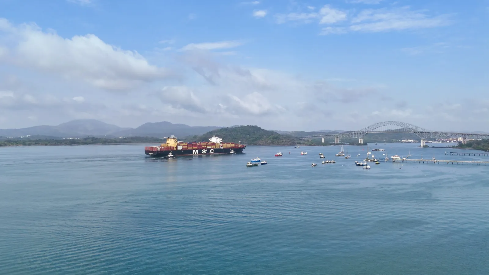
There's no single general admission fee for "the Canal" as a whole. There are free public spots to watch ships pass, such as the Mirador de las Américas, next to the Bridge of the Americas in Arraiján.
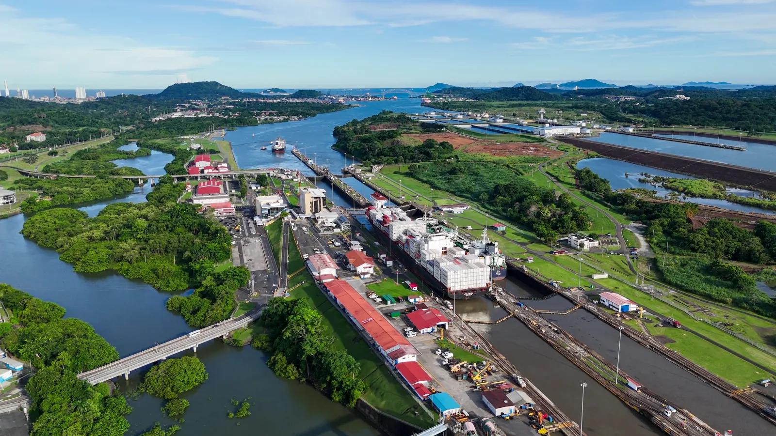
A ship can take eight to ten hours to cross from one ocean to the other, lifted and lowered by the locks like giant water elevators. That's how the Panama Canal has worked for more than a century: a roughly 80-kilometer waterway that links the Caribbean Sea with the Pacific Ocean across the isthmus, letting ships skip the long, hazardous route around South America.
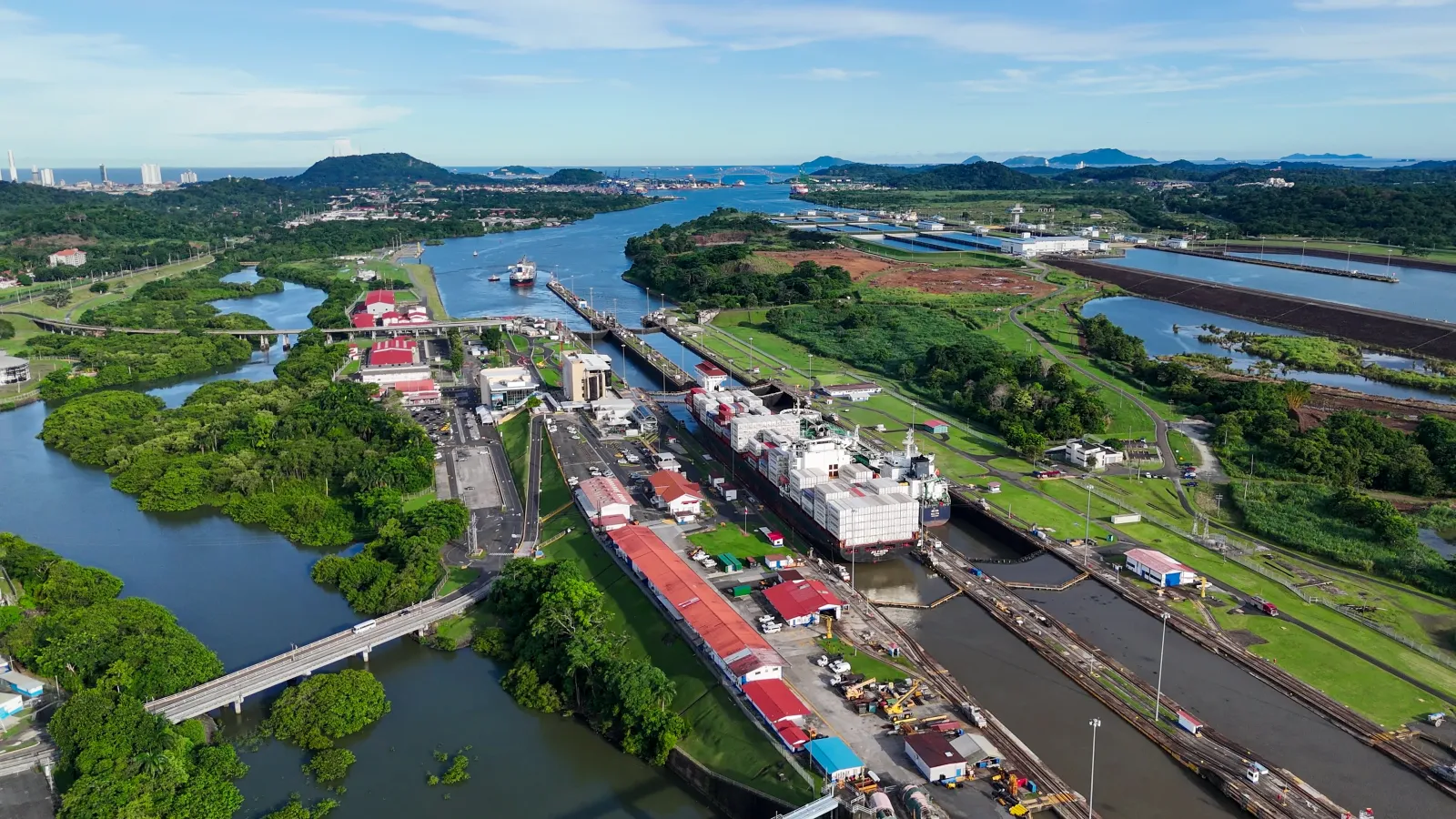
The original system, opened in 1914, runs on three sets of locks — Gatún, Pedro Miguel, and Miraflores — whose chambers, 304.8 meters long by 33.5 meters wide, raise vessels to Gatún Lake, about 26 meters above sea level. Since 2016, a third lane with the Cocolí and Agua Clara locks has allowed larger neopanamax ships to pass through.
Vessels from around the world cross the Canal every day, in an operation that never stops: it runs 24 hours a day, 365 days a year, powered by the work of thousands of people. For visitors, the most accessible way to experience it is watching ships pass through the locks from one of the public visitor centers — one on the Pacific side, one on the Caribbean side — each with its own hours and admission fee.
Explore the place
Image gallery
Photo of 2
Understand the place
History
Construction began with a French attempt in 1881, led by Ferdinand de Lesseps' company, which hoped to repeat the success of the Suez Canal. The project stalled in 1889, undone by financial troubles and the tropical diseases that decimated workers.
The United States took over the project in 1904 and finished it in 1914, after years of digging through the Central Cordillera at what's known as the Culebra Cut — today the Gaillard Cut — 13.7 kilometers long. Using locks instead of a sea-level channel let engineers overcome the terrain's elevation by relying on water from Gatún Lake, an artificial lake formed by damming the Chagres River.
For much of the 20th century, the Canal and the surrounding strip of land — the Canal Zone — remained under U.S. administration. The Torrijos-Carter Treaties, signed in 1977, set out the gradual handover of the Canal to Panama. Panama's constitution added a chapter devoted entirely to the Canal in 1994, and in 1997 the Organic Law creating the Panama Canal Authority (ACP) — the autonomous body in charge of running it — was enacted.
Administration formally passed into Panamanian hands in 1999. A few years later, in 2006, a national referendum approved an expansion project to build a third set of locks able to handle much larger ships than the original design allowed. Work began in 2007, and the expanded Canal — with the new Cocolí locks on the Pacific side and Agua Clara on the Atlantic side — opened on June 26, 2016.
Today the Canal is still run by the ACP as an inalienable asset of the Panamanian nation, and it continues to expand its role in global maritime trade more than a century after it first opened.
Culture
The Canal's operation depends on the daily work of thousands of people — close to 9,000, according to ACP figures — including pilots, tugboat captains, lock operators, and technical and administrative staff. This workforce, popularly known as the canaleros, keeps the Canal running 24 hours a day, 365 days a year.
Pilots and captains train at the ACP's own specialized simulation centers, where transit maneuvers are practiced before working with real vessels. It's a technical, high-responsibility trade passed down and adapted across generations, from the era of U.S. administration to Panama's current management.
Broader aspects of identity, traditions, or community practices specific to the populations settled along the Canal: Pending verification.
Area and surroundings
The Canal is laid out as a continuous strip of water and land crossing the isthmus from one ocean to the other. On the Caribbean end, in Colón province, sit the Gatún locks and the newer Agua Clara locks, next to the Agua Clara Visitor Center on Calle Golf. From there, the waterway opens into Gatún Lake, a large artificial lake that covers much of the route and that ships cross before descending toward the Pacific.
South of the lake, the Culebra Cut — a 13.7-kilometer stretch dug through the Central Cordillera — connects to the Pedro Miguel locks and, further on, to the Miraflores locks, already in Panamá province. Next to the latter sits the Miraflores Visitor Center, with its observation platform, viewpoint, and theater. Nearby, on the same Pacific side, the expanded Cocolí locks also operate.
Altogether, the area combines working port and industrial infrastructure with stretches of open water, so the visitor experience is concentrated at the two public visitor centers, each representing one end of the system.
Practical tips
Buy your ticket online before you go: both visitor centers offer this, and it saves you the ticket-booth line. Check the ticket-sale hours, which run shorter than the general visiting hours at both sites.
If seeing a ship transit is your main interest, keep in mind that ships don't pass continuously throughout the day; without checking ahead, you may end up seeing only the exhibits and not an actual transit.
At the Miraflores Visitor Center, admission includes the IMAX theater film, which runs on a fixed screening schedule — arrive early if you want to catch it in full. At the Agua Clara Visitor Center, check beforehand that the restaurant, snack bar, and gift shop may be temporarily closed, per the administration's current information.
If you plan to walk Agua Clara's ecological trail or countryside path, wear comfortable, closed-toe shoes and bring water and sun protection, since these are outdoor walks in a tropical climate. Carry cash as well as a card, in case the point of sale requires it. Always confirm current hours and fees with the official source before traveling, since they can be updated.
How to get there
The Canal spans two provinces and has no single access point. On the Pacific side, in Panamá province, it's reached by paved road from Panama City; on the Caribbean side, in Colón province, the main access is via the road leading to the Gatún area.
There are free public spots to watch ships pass, such as the Mirador de las Américas, next to the Bridge of the Americas in Arraiján. Access there has been restricted due to on-site work since late 2025; it's worth checking whether it's open before planning a visit.
The Canal's main managed attractions — such as the Miraflores and Agua Clara visitor centers — have their own listing, with specific access, hours, and pricing. Detailed routes, travel times, and road conditions: Pending verification.
Opening hours
El Canal opera 24 horas al día, los 365 días del año, pero eso no equivale a un horario de visita. Los atractivos administrados dentro del Canal tienen su propio horario, detallado en sus respectivas fichas.
We use analytics cookies to understand which content is most useful and improve the site. They are enabled only if you accept them, and you can change your choice here. Read our
privacy policy.
Analytics cookies
They are optional and help us improve the content.
 Panamá